


| Other Sellers | Prices | ShippingCost | |
|---|---|---|---|
| amazon.com | US $2.9 | US $0.9 | buy in amazon |
| us.shein.com | US $0.9 | US $1.9 | buy in shein |
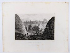
Antique Map of New York City, free shipping, good for framing
ebay.com
gtbpwa100.0% positive rating
US$14.99
Antiques
Maps, Atlases & Globes
North America Maps
shippingCost free
most popular

1832 UNITED STATES Map ORIGINAL HYDE & FIELD TEXAS NORTHWEST TERRITORY
$284.00

Pennsylvania 1796 Harris Doolittle rare American hand colored early state map
$280.00
$350.00
Bestseller
20% OFF

1848 MEXICO - REPUBLIC OF TEXAS Map ORIGINAL Jeremiah Greenleaf (12X10)
$248.00

1890 Cape Cod & Martha’s Vineyard Old Colony Line Antique Map
$240.00

North America continent New Albion 1750 Vaugondy nice hand colored engraved map
$236.00
$295.00
Bestseller
20% OFF

Rare 18thC Map Newfoundland Canada N America by Herman Moll 1739 Point Riche
$235.39

1854 Mitchell / Thomas, Cowperthwait & Co Atlas Map State of Virginia / WV
$200.00

1879 VIEW of NANTASKET Beach - HULL - MASSACHUSETTS - Map ORIGINAL (25X15)
$189.00

1875 TEXAS & INDIAN TERRITORY Map ORIGINAL (16X14) WIGEFARTH Alamo Houston
$188.00

Yellowstone National Park Wyoming 1871 Hayden folding map advertising on reverse
$180.00
$225.00
Bestseller
20% OFF

1854 Mitchell / Thomas, Cowperthwait & Co Atlas Map State of Missouri
$160.00

1854 Mitchell / Thomas, Cowperthwait & Co Atlas Map State of Illinois
$160.00

Antique 19th Century Butler County Land Survey Map w/ Family Names Pennsylvania
$149.95

1874 NORTH WESTERN WYOMING Map MILITARY RECONNOISSANCE - W.A. Jones ORIGINAL
$148.88

STATE of TEXAS - 1864 Map ORIGINAL Johnson & Ward - CIVIL WAR Original (24x16)
$138.88

MANHATTAN Original map 1909Broadway Central Park NEW YORK CITY ANTIQUE MAP
$100.00

1861 Johnson’s New Illustrated (Steel Plate) Family Atlas. MISSING PLATES.
$99.95

State of Florida around 1853 Ensign miniature hand colored map nice patina
$78.40
$98.00
Bestseller
20% OFF

Florida great early state map 1870 Johnson large hand colored map w/Keys inset
$76.00
$95.00
Bestseller
20% OFF

Boston city plan Massachusetts 1870 Johnson large hand colored map
$76.00
$95.00
Bestseller
20% OFF

1880 UNITED STATES Map ORIGINAL ANNUAL TEMPERATURE (16X10) DATED - GANNETT
$58.00

Illustrated Summit County Ohio Map & Atlas (1891 reprint) Oversized
$51.50

1880 UNITED STATES Map ORIGINAL MAXIMUM - Temperature (16X10) DATED - GANNETT
$48.88

1880 UNITED STATES Map ORIGINAL FOREIGN POPULATION (16X10) DATED - GANNETT
$48.00

1929 BROOKHAVEN - SELDEN - LONG ISLAND Map ORIGINAL Suffolk County (21x13)
$44.88

1929 BRIGHTWATERS - ISLIP - BABYLON - LONG ISLAND Map ORIGINAL Suffolk (23x15)
$44.88

1848 WESTERN HEMISPHERE Map ORIGINAL Greenleaf TEXAS REPUBLIC Canada
$38.88

1848 ILLINOIS Map ORIGINAL (12x10) GREENLEAF CHICAGO PEORIA RAILROAD
$38.88

1890 PISCATAQUIS County MAINE Map ORIGINAL (24X14) Dover - Foxcroft
$38.00

1875 CHICAGO - ILLINOIS Map ORIGINAL (13.5X11) Mitchell Atlas LINCOLN PARK
$38.00

1875 Plat Map BURNS - Township ILLINOIS - Henry County (16x13) ORIGINAL
$38.00

North America 1652 Vintage Style Early United States Map - 36x42
$36.95

1890 UNITED STATES - BARLEY Map ORIGINAL Agriculture FARMING (15X10)
$36.88

ORIGINAL HAWAII 1930'S MAP RUTH TAYLOR WHITE
$35.00

1855 WYOMING - TETON VALLEY Original Hand-colored LITHOGRAPH
$34.88
1831 PASSAIC RIVER SOURCE - NEW JERSEY Original Engraved Print
$34.88

1907 SOUTH CAROLINA - Map ORIGINAL LARGE (20X13) RAILROADS CHARLESTON
$34.88

1907 ALABAMA - Map ORIGINAL LARGE (20X13) RAILROADS MOBILE - MONTGOMERY
$34.88

1907 WEST VIRGINIA - Map ORIGINAL LARGE (20X13) RAILROADS - CHARLESTON
$34.88

1879 KINGSTON - MASSACHUSETTS Map PLYMOUTH County ORIGINAL (16X12)
$34.88

1862 Military & Railroad Map US Civil War Era - 24x32
$24.95

1771 Early American 13 Colonies - East Coast Map - 24x28
$23.95

VINTAGE 1949 ENSENADA / HUSSONG'S CANTINA MAP AND BROCHURE
$19.99
North America 1771 Colonial Map - 13 Colonies - 20x24
$16.95

1835 Texas, Indian Territory & Mexican States Map Wall Map - 20x24
$16.95

Map of Crawford Notch, NH (White Mountain National Forest) 1946 Edition
$15.00

LOWER NEW YORK MANHATTAN Original Map City Plan 1909 Battery Park Wall Street
$14.00

1933 Long Island NY Classic Pictorial Historic Map - 16x24
$13.95


